Comparison
Fincabout vs Google Earth and SketchUp
Fincabout is a complete farm management platform - livestock, yields, expenses, financial dashboards, visual design, AI renders, and 3D walk mode - purpose-built for agriculture. Google Earth and SketchUp are general-purpose tools with no farm management capabilities.
The verdict
Fincabout delivers everything a farm needs in one platform: full livestock management, yield tracking with revenue, expense dashboards, inventory, supplier management, budgets, task tracking, visual farm design with 310+ tiles, AI renders, 3D walk mode, and Finca AI advisor. Google Earth and SketchUp are powerful general-purpose tools, but they have zero agricultural intelligence - no crop data, no livestock tracking, no financial management, no companion planting. Fincabout is the purpose-built choice.
Only on Fincabout
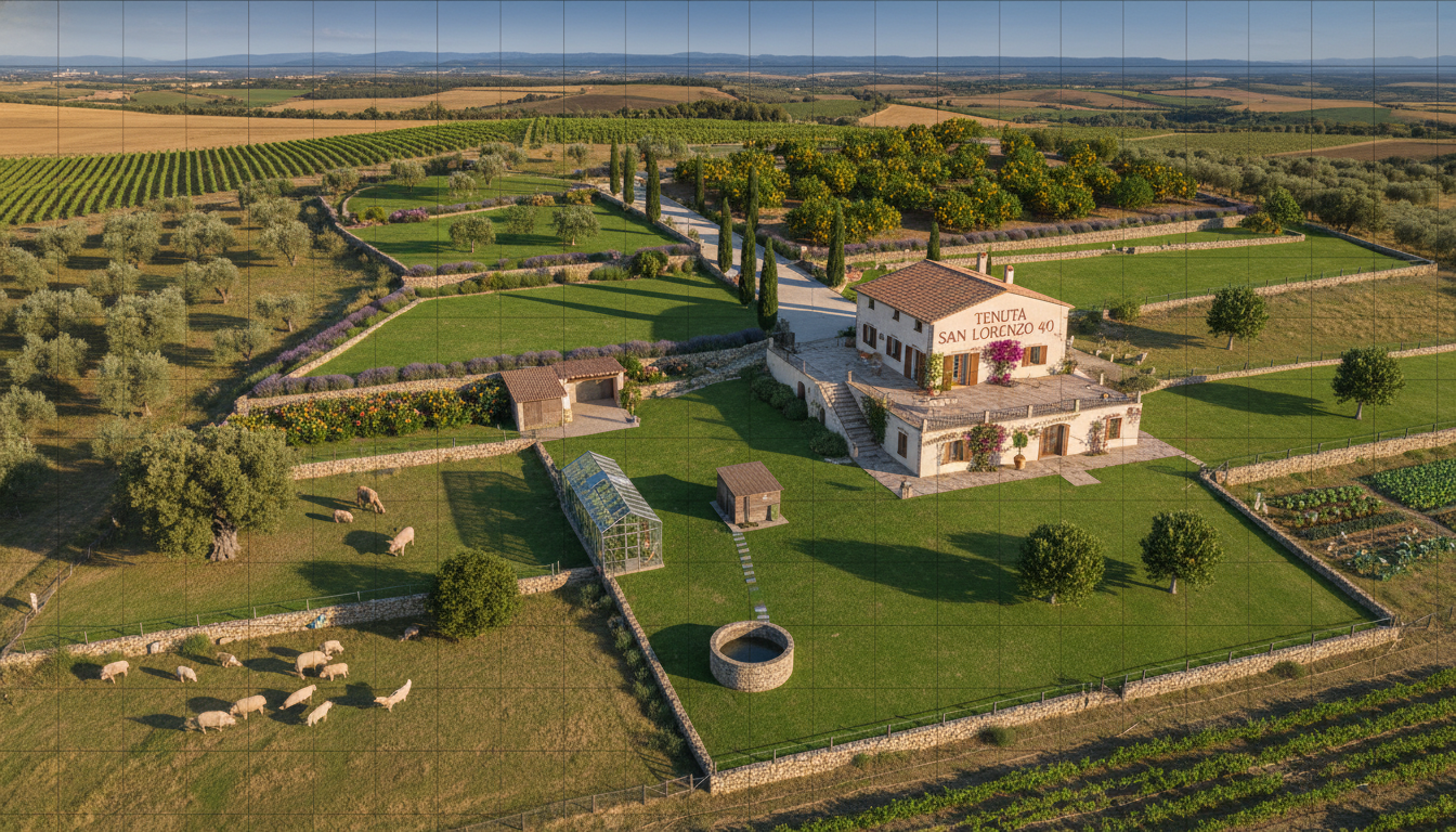
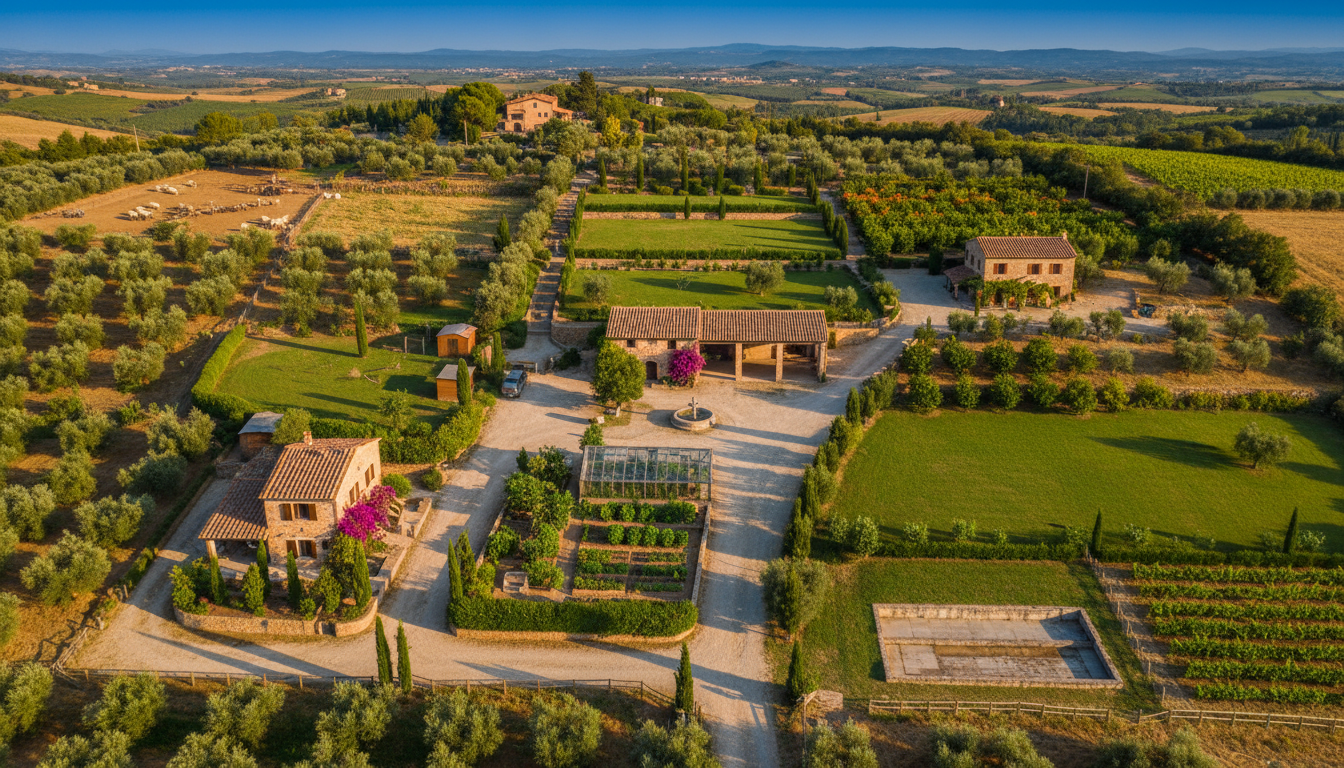
Purpose-Built Farm Renders vs Generic Satellite Imagery
Google Earth shows you what your land looks like right now. Fincabout renders what your farm could look like - with specific crops, structures, and infrastructure placed exactly where you want them. Agriculture-specific visualization, not generic terrain photos.
Google Earth provides satellite imagery of existing terrain. It cannot render planned farm layouts or agricultural designs.
Learn more about AI renders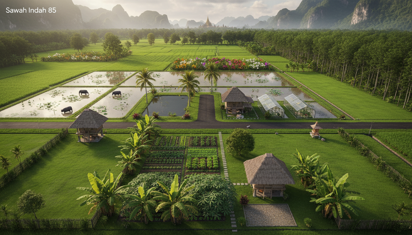
I have 5 acres of south-facing slope with clay loam soil. What should I grow?
South-facing slope with clay loam is excellent for fruit trees and vines - the drainage and sun exposure are ideal. I recommend 2 acres of apple orchard (high-density at 1,000 trees/acre), 1.5 acres of wine grapes, and 1.5 acres of market vegetables on the lower slope where clay retains moisture for greens. Expected annual revenue at maturity: $42,000-$58,000.
The climate has been getting hotter. Should I adjust my crop choices for the next 10 years?
Smart to plan ahead. For your zone, consider shifting toward heat-tolerant varieties - Fuji and Honeycrisp apples handle heat better than Gala. For grapes, Tempranillo and Mouvedre thrive in warmer conditions. On the vegetable side, swap cool-season crops for okra, sweet potatoes, and peppers as summer anchors. These adjustments could maintain yields even with 2-3 degrees of warming.
Ask Finca about your farm...
Only on Fincabout
AI That Knows Agriculture - Not Just Geography
Google Earth can show you soil types and elevation. Finca AI tells you what to grow there, when to plant it, and how much revenue to expect - based on your specific location, climate, and goals.
- Recommend crops based on your specific soil, slope, and sun exposure
- Suggest climate-resilient varieties for long-term planning
- Calculate expected revenue for different land-use scenarios
- Design complete farm layouts from scratch with agricultural intelligence
Google Earth and SketchUp have no agricultural intelligence, crop data, or farming recommendations.
Learn more about Finca AIOnly on Fincabout
Walk Through Crop Rows and Structures - Not Just Fly Over Terrain
Google Earth lets you fly over your land. Fincabout lets you walk through it at ground level - between crop rows, inside orchard grids, and around structures you have placed. Experience the scale and spacing of your design before investing a dollar.
WASD
Move around
Mouse
Look around
Shift
Sprint
Google Earth offers aerial flyover views of existing terrain. There is no ground-level walk mode or ability to explore planned designs.
Feature comparison
Where Google Earth / SketchUp excels
Google Earth provides global satellite imagery and terrain data for free. SketchUp is a capable general-purpose 3D modeling tool with a large library of user-created models. Together, a skilled user can create custom 3D visualizations - though with no agricultural context built in.
Where Fincabout stands out
Complete farm management platform
Livestock management with breeding and health records, yield tracking with revenue, expense dashboards, inventory, supplier management, budgets, and task tracking. Google Earth and SketchUp offer none of this.
Agriculture-specific by default
310+ crop and structure tiles, growing seasons, companion planting, regional theme packs, and Finca AI advisor. In Google Earth or SketchUp, you start from a blank canvas with zero agricultural context.
Minutes, not hours
Design a complete farm layout in minutes using the tile editor. Creating an equivalent layout in SketchUp could take hours or days, requiring 3D modeling skills and manual placement of every element.
AI renders and 3D walk mode
Turn your tile-based design into photorealistic farm imagery with one click and walk through it in 3D. SketchUp requires plugins, rendering software, and significant setup to produce comparable visuals.
Pricing comparison
Fincabout
Google Earth / SketchUp
Google Earth is free for personal and educational use. SketchUp offers a free web version with limited features. SketchUp Pro costs around $349/year for full desktop functionality. SketchUp Studio, which includes advanced rendering and analysis tools, is approximately $749/year.
More Comparisons & Solutions
Frequently Asked Questions
Trusted by farmers worldwide
What Farmers Are Saying
Real stories from growers, homesteaders, and designers using Fincabout.
Ready to try a better approach?
Start with the free plan. No credit card required. See why farmers are switching to Fincabout.